Hunting Apps for OSINT
by HeckSec
Technology advancements have impacted every aspect of the world since the dotcom boom of the early 2000s.
Virtually all industries have capitalized on this boom and the outdoors industry is no exception. Technology has changed the way hunters hunt: GPS improvements (smaller, more accurate), clothing (lighter, stronger, with scent technology), and weaponry (lighter, stronger, cheaper, etc.), to name a few.
In the last ten years, there has been a surge of web and mobile applications that were designed to aid outdoor advocates in planning, scouting, and executing successful hunts. Hunting and land management apps such as OnX Hunt (www.onxmaps.com/hunt/app) and HuntStand (www.huntstand.com) offer users the ability to search for properties by ownership and location.
These apps provide helpful information to hunters, but this short article will show you how their standard features can be leveraged to identify property ownership information during Open-Source Intelligence (OSINT) investigations. For example, it is possible for a private investigator to locate property owners for a client, or a journalist to tie an Limited Liability Company (LLC) to a specific property. Although there are other applications that can provide property information (such as Zillow or Redfin), these apps are limited in that they do not provide ownership information.
All of the examples and screenshots provided were created using the OnX Hunt web application. The app is available on Android devices, iOS devices, and as a web application. All information in this article was gathered by using a free trial. The trial is offered to new users after creating a free account. The account was created by providing an ephemeral email address from a free online email service. No credit card information required! HuntStand has also been confirmed to offer property ownership information. Although HuntStand has similar features and functionality, it is not featured in this article. There was effort to redact the full names of all property owners in the images used for this article.
App Features
There are many different features within the OnX Hunt app, but this article highlights map layers, location searches, and owner searches.
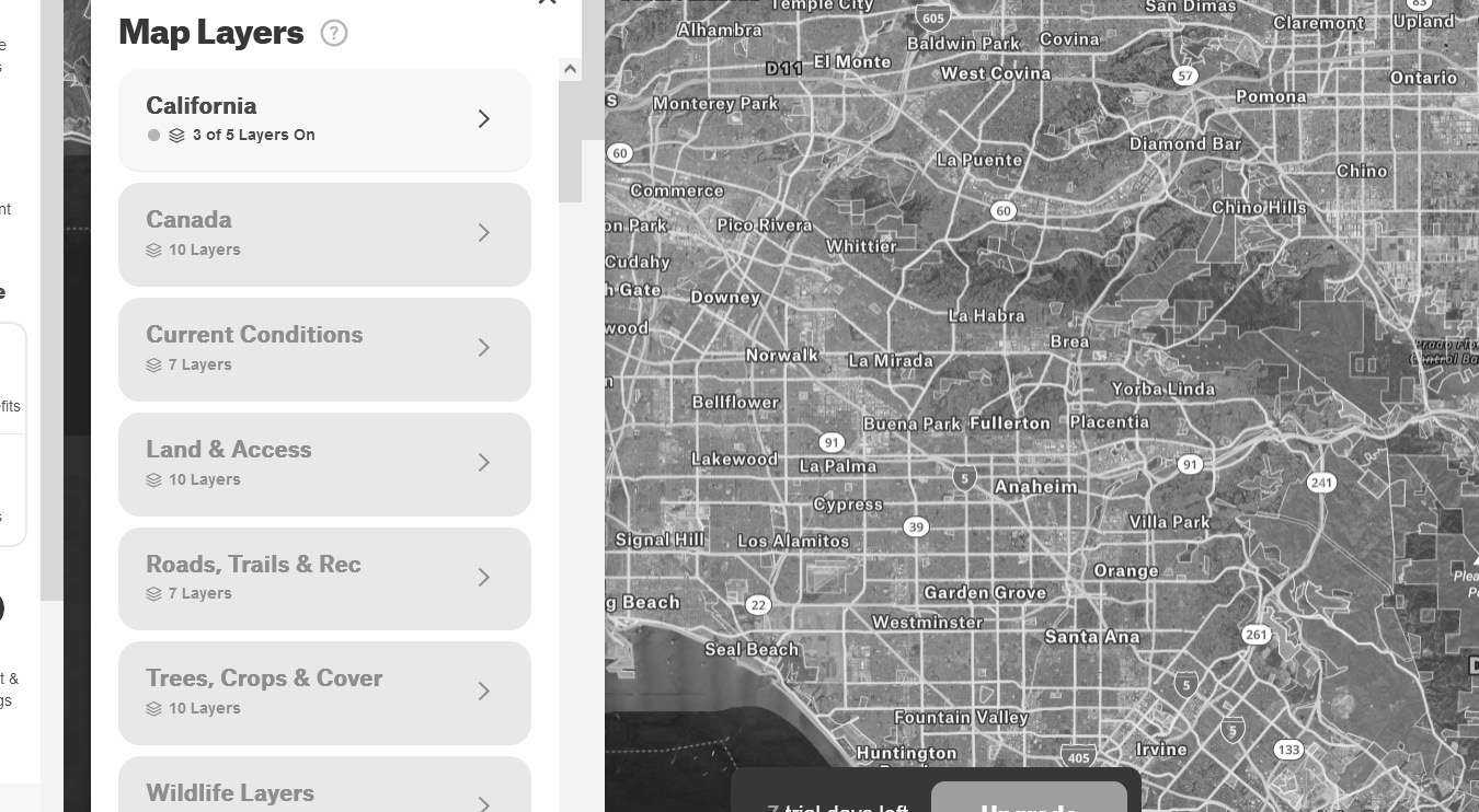
This image provides insight into available map layers. A user can choose specific states (or Canada) to focus on and select conditions such as air quality, smoke forecast, slope angles, and trails.
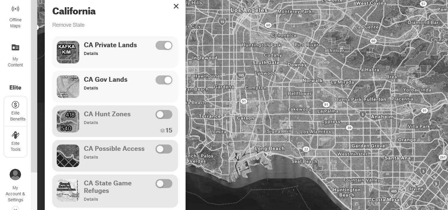
This image highlights options within the California map layer. Notice the "CA Private Lands" layer option. This is the specific layer that makes hunting apps valuable for OSINT investigations. Make sure this layer is turned on before continuing.
People and Places
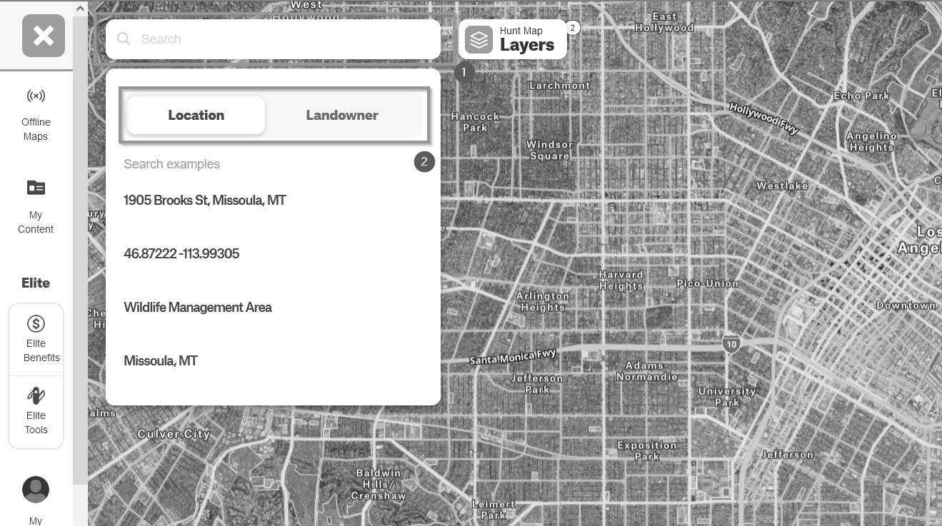
Clicking on the search box near the top-left allows users to search by property location or property owner.
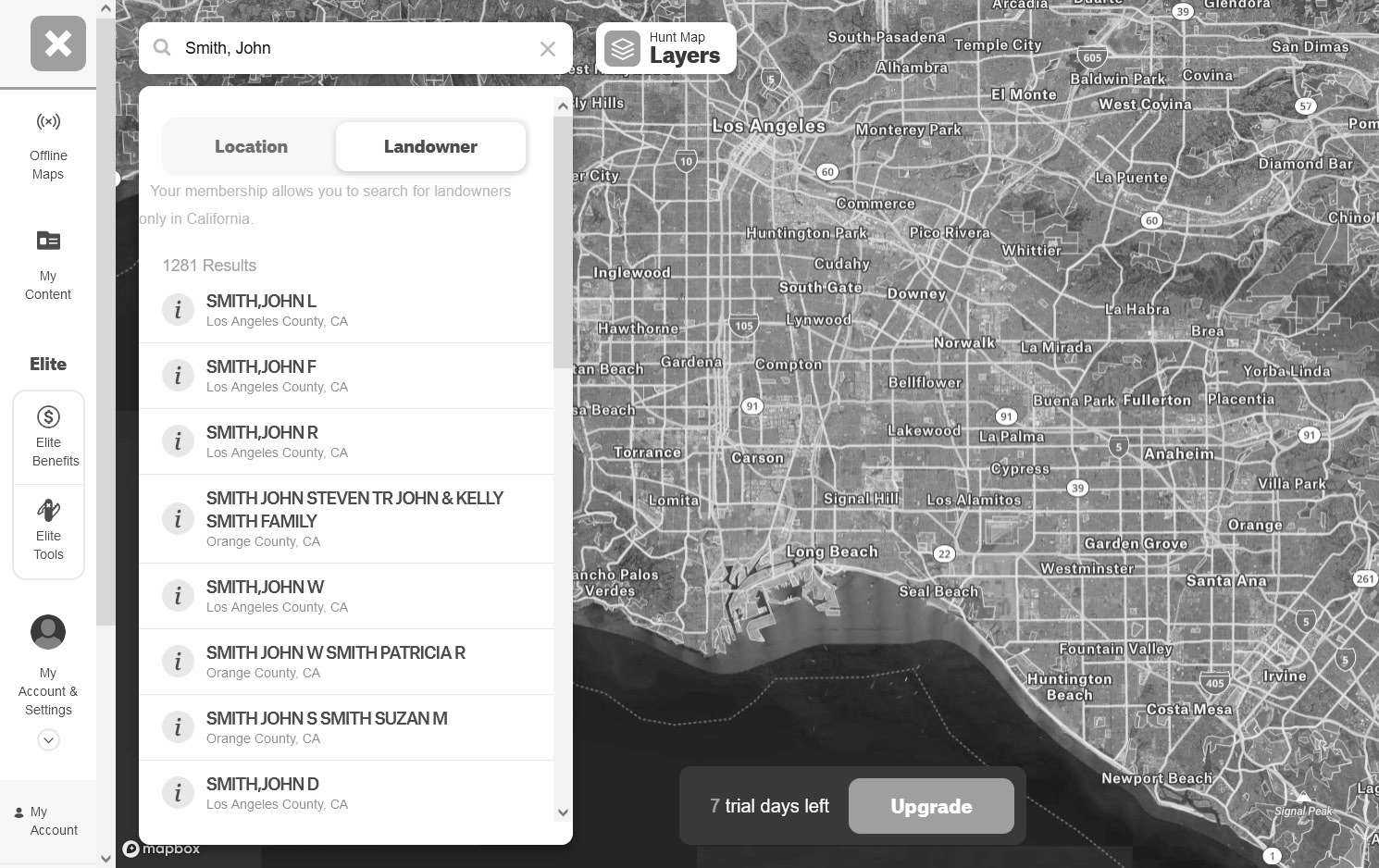
While searching for landowners, the app will suggest results (the name John Smith was only used as an example).
Clicking on a landowner's name will take the user to the property in question.
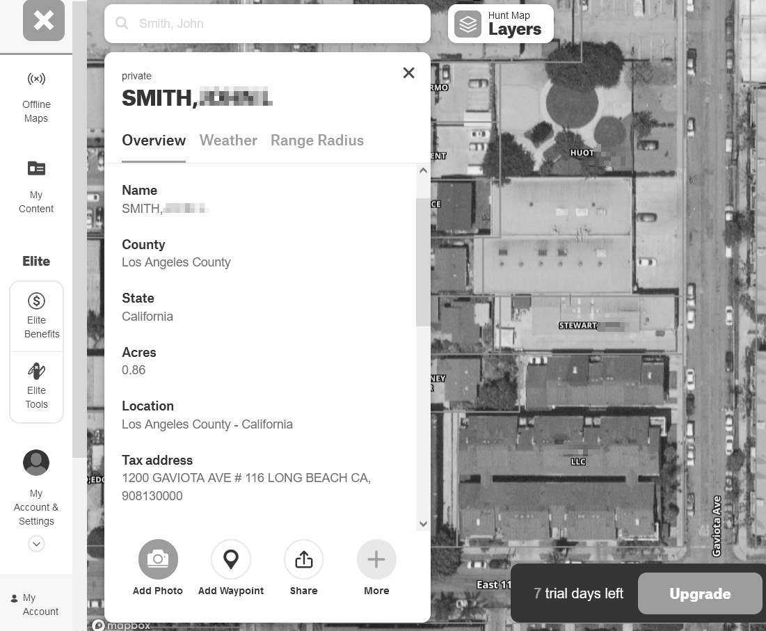
The app will provide name, county, state, acres, location, and a tax address. In this image, the names of property owners have been redacted.
Notice some of the properties are owned by LLCs. A LLC can be a great privacy tool for assets if used correctly. Michael Bazzell discusses this topic at length in his book, Extreme Privacy: What It Takes to Disappear.
The power of these apps is also showcased by the ability to add waypoints (tag specific locations) and draw boundaries. Hunters use these features to build and plan hunting trips, while an OSINT practitioner can use them to organize investigations.
Although the OSINT benefits of hunting apps are clear, no tool is perfect.
At times, information may be outdated. One could argue that all information during an investigation should be cross-referenced with other tools and techniques to prove validity. With regards to property information within these hunting apps, old public records could be to blame for outdated property. Apps could also reflect outdated information if they are slow to update their back-end services.
The following section discusses this potential obstacle using Dodger Stadium as an example.
Misleading Information?
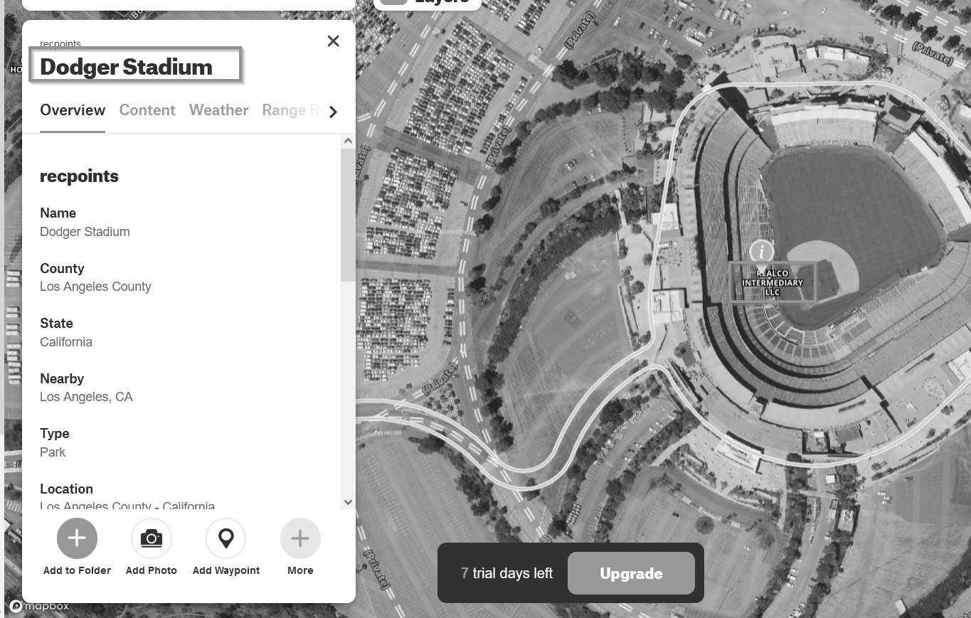
Using the app's location search feature, a user can easily find Dodger Stadium (the app will zoom into the location of the property once it's selected from the search suggestions).
In this image, the app displays the stadium owner as Realco Intermediary LLC, which isn't correct. A quick Yandex search indicates that Frank McCourt, the previous owner of the Los Angeles Dodgers, was an officer of this LLC at some point.
The issue is that Frank sold the Dodgers to Guggenheim Baseball Management in 2012. Although the Dodgers have had new ownership since 2012, this snippet from Wikipedia (en.wikipedia.org/wiki/Guggenheim_Baseball_Management) may explain the lack of property ownership changes within the OnX app (and thus public record); "According to Guggenheim Baseball Management, McCourt will have no control or influence over the land, but will profit from potential future development of it."
This is only a theory and does not prove that all property information is inaccurate. Feel free to validate the information provided by the app by searching for yourself, your family members, or friends and neighbors.
Summary
The original intent of these apps and their features was not to feed the paranoia of the privacy conscious technologist.
Hunters all over North America have used these apps to ask landowners permission to hunt on private land. Outdoors men and women have clearly benefited from the breadth of technology improvements imposed on hunting gear and apps in the last decade.
In this case, the improvements can be a valuable addition to an OSINT professional's toolbox.